You are here
NOAA Pacific Tsunami Warning System

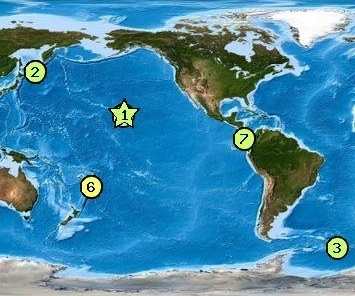
In the aftermath of the devastating Pacific Ocean tsunamis of December 2004 that left scores drowned in Indonesia, Thai Land, and Southeast Asia, authorities knew they had to raise the bar on tsunami detection and alert - and they have. The Pacific Tsunami Warning System operated by National Oceanic and Atmospheric Administration (NOAA), has since creating a new standard by significantly expanding it technical capabilities and geographic reach. In 2008 they completed installation of the first oceanic network of automated tsunami detection buoys which can sense the presence of these monster waves while they are still far out at sea and relay warning via satellite in time for evacuation.
* The network of these buoys, referred to as DART stations, for "deep-ocean assessment and reporting of tsunami", now form the cornerstone of the Tsumani Warning System.
* Other components of the warning system include seismic recorders, tide gages, forecast models and emergency communication channels on geosynchronous satellites.
* Almost every Pacific Rim country is now covered by the warning system.
As the primarly operational headquarters for the Pacific Tsunami Warning System, PTWC provides warnings for Pacific basin teletsunamis (tsunamis that can cause damage far away from their source) to almost every country around the Pacific rim and to most of the Pacific island states. This function is carried out under the auspices of the UNESCO/IOC International Coordination Group for the Pacific Tsunami Warning System.
http://www.noaanews.noaa.gov/stories2008/20080310_buoy.html
NOAA Launches Final Two Buoys to Complete U.S. Tsunami Warning System
March 10, 2008

NOAA DART II buoy.
+ High Resolution (Credit: NOAA)
NOAA deployed the final two tsunami detection buoys in the South Pacific this week, completing the buoy network and bolstering the U.S. tsunami warning system. This vast network of 39 stations provides coastal communities in the Pacific, Atlantic, Caribbean and the Gulf of Mexico with faster and more accurate tsunami warnings.
These final two deep-ocean assessment and reporting of tsunami (DART) stations, deployed off the Solomon Islands, will give NOAA forecasters real-time data about tsunamis that could potentially impact the U.S. Pacific coast, Hawaii and U.S. Pacific territories. Tsunami sensors are now positioned between Hawaii and every seismic zone that could generate a tsunami that would impact the state and beyond, including the U.S. West Coast. Buoys already in the western Atlantic, Gulf of Mexico and Caribbean have been keeping watch over the U.S East and Gulf coasts.
Other components of the tsunami warning system include NOAA’s tsunami warning centers, a network of tide and seismic stations, forecast models for at-risk communities, and TsunamiReady™, a public preparedness and education program.
Since the Indonesian tsunami of December 2004, NOAA has made significant upgrades to the U.S. tsunami warning system, including:
- Installing 49 new or upgraded tide gages
- Installing or upgrading eight seismic stations
- Expanding the network of DART buoys from six (exclusively in the eastern Pacific) to 39 (from the western Pacific to the Atlantic)
- Growing the number of TsunamiReady communities from 16 to more than 50 today
- Developing 26 inundation forecast models and implementing a new Tsunami Warning System
- Extending the operations of the Pacific and West Coast/Alaska Tsunami Warning Centers to 24 hours a day
- Assisting Australia and Indonesia with installing tsunami warning systems off their coasts.
US Dept of Commerce / NOAA / NWS
Pacific Tsunami Warning Center
91-270 Fort Weaver Rd
Ewa Beach, HI 96706-2928 USA
Phone: 1-808-689-8207
Email: webmaster@ptwc.noaa.gov
- Log in to post comments


